
El Niño strengthens as forecasts point to a very strong event
Warming in the Pacific is already accompanied by shifts in winds and rainfall. The event’s peak strength, however, still depends on how it develops over the coming months.
Leitura autorizada · 3 crédito(s) restante(s)
The central and eastern equatorial Pacific is warmer than average, and the atmosphere is already responding: winds and rain belts are shifting over the ocean. A September 21 bulletin from the U.S. National Oceanic and Atmospheric Administration, NOAA, confirms that El Niño is present and maintains a forecast issued on September 10: the chance of a very strong event during the Northern Hemisphere’s fall and winter of 2026–2027 exceeds 90%.
El Niño is a coupled change in the ocean and atmospheric circulation. Trade winds ordinarily push warm surface water westward, toward Asia and Oceania. When these winds weaken, warmth spreads farther into the central and eastern Pacific, and the upwelling of cold, deep water near South America becomes less effective. This redistribution also helps shift the places where air rises and produces rain.
The signs described by NOAA already show this rearrangement. Over the 30 days covered by the bulletin, cloud formation and rainfall were above average across a band extending from the international date line to the eastern Pacific, and below average in parts of Indonesia, the southern Philippines, and Papua New Guinea. By shifting areas where air rises strongly, ocean warming changes atmospheric circulation and can have effects far from the Pacific.
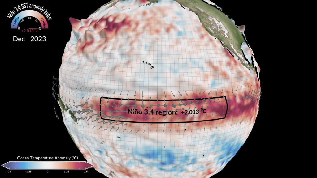
To track this transformation, observing networks measure water temperature, currents, and winds. Buoys transmit these data daily. One area used in the assessment, called Niño 3.4, spans an equatorial band in the central and eastern Pacific. The difference between its surface temperature and the climate average indicates how much warmer or cooler the water is than the reference.
An event’s strength also depends on how long that difference persists. In NOAA’s assessment, a relative index subtracts the average warming of the tropical oceans and tracks changes through three-month averages. That subtraction helps distinguish warming specific to this part of the Pacific from warming shared across the tropics. The classification presented by CCSR–IRI, Columbia University’s climate research and forecasting center, also compares the temperature in Niño 3.4 with a climate reference, but without the same relative adjustment.
Despite the different criteria, the forecasts converge on a strong event. In IRI’s September 21 update, the 22 models assembled by the center project conditions classified as very strong from September–November 2026 through December 2026–February 2027. These are different projections of the same phenomenon; accuracy varies among models and tends to decrease when they try to anticipate more distant periods.
Monitoring over the coming months will reveal El Niño’s sustained strength, something a single day’s temperature cannot settle. For preparedness, the combination of observed changes and seasonal forecasts already matters: it directs attention to water availability and food production. Expectations for rainfall in a particular city or farming area, in turn, require forecasts for that region.
Key points
- NOAA’s September 21 bulletin confirms El Niño and associated changes in Pacific winds and rainfall.
- The forecast issued on September 10 gives a greater than 90% chance of a very strong event during the Northern Hemisphere’s fall and winter of 2026–2027.
- Assessing the event’s strength relies on multimonth averages and comparison criteria, not a single daily temperature.
Comments
No comments have been published yet.
Sign in with a subscription to comment.